A sunny and hot Tuesday morning! What more could I ask for? Well... I could have asked for a little less wind, but that certainly didn't stop me! As I had the day before, I took my map to breakfast and planned a route which would allow me to explore the Talking Rocks Cavern just outside Branson West then take me to Eureka Springs, Arkansas.
Day Four Route (counterclockwise)
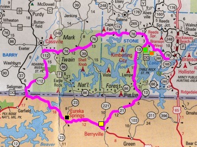
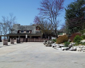
I headed out of Branson on Highway 76 west. I'd missed going down the Indian Point Road the previous day so I decided to check it out first thing. The first thing I saw when I wandered down the road was Silver Dollar City. Although it was closed (opening that weekend, April 4th), the staff let me in to take a couple of pictures of buildings near the entrance.
Silver Dollar City Entrance
Silver Dollar City inside entrance
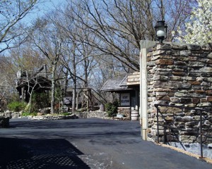
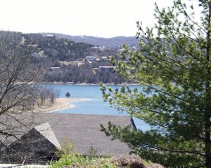
I continued down the Indian Point road and came across condos with a view! (Note: The location of Silver Dollar City/Indian Point is marked with an orange square on the map.)
Indian Point
View to the East from Treehouse Condos
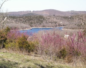
Indian Point
View to the West from Treehouse Condos
I continued to the end of Indian Point where there was a marina.
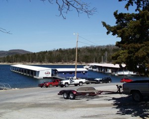
Indian Point Marina
Cafe on the Lake
After visiting the marina, I headed back up to highway 76 west to Branson West. Talking Rocks Cavern awaited. (Green Square on map)
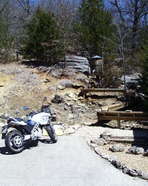
Mining Sluice
Outside Entrance to Talking Rocks Cavern
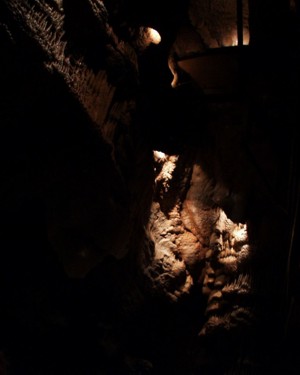
Talking Rocks Cavern
On the stairs leading down 100 feet
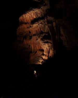
Talking Rocks Cavern
The Cathedral
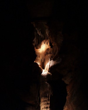
Talking Rocks Cavern
Formations - check out the natural "hole"
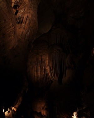
Talking Rocks Cavern
"Angel" Formation
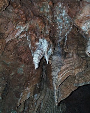
Talking Rocks Cavern
Formations that they call "bacon"
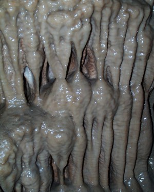
Talking Rocks Cavern
This is the "slime" which creates the rock formations!
My stop at Talking Rocks Cavern probably took a little too long, but I decided to push on to Eureka Springs regardless. I headed on down 13 over that great bridge at Kimberling City (still no place to stop!) then at Blue Eye (right on the Missouri/Arkansas border) the highway became 21. That wasn't the only thing that changed! The country was less "mountainous" but more rolling. There were lots of smooth curves through cattle country.
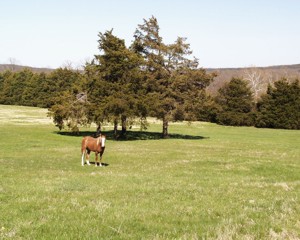
This farm just outside Berryville shows the character of the Arkansas area along Highway 21. (Yellow square on map)
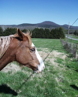
Like everyone else in the area, the horse was friendly!
I headed west on Highway 62 from Berryville and eventually ended up in Eureka Springs (black square on map). The terrain in between was almost all switch back roads up a mountain and down a mountain, over and over! Spectacular and very much fun! Eureka Springs itself was on the side of one of those mountainsides and I couldn't quite decide where to stop for lunch. Lucky for me, Dowd's Catfish House caught my eye and soon the friendly waitress there served me catfish and hush puppies. YUM! And for those of you saying, You ate those bottom-feeders?, yes, I did. The catfish you eat down here aren't river caught; they're from a hatchery!
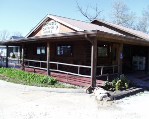
Dowd's Catfish House
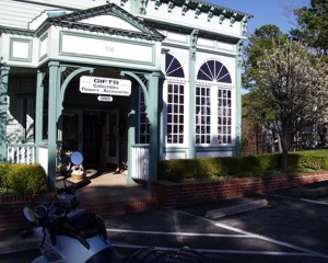
Once I finished my LATE lunch, it was time to boogie! The sun was getting a little too low for my liking. Besides not being allowed to drive during the evening hours, I had no desire to! Too many twists and turns leading right off the sides of the many hills and mountains... and NO lighting ANYWHERE despite the big hydro plants in the area. I only stopped briefly to take pictures of a neat shopping mall and a couple of Victorian mansions which were totally spiffy!
Eureka Springs
Pine Mountain Village
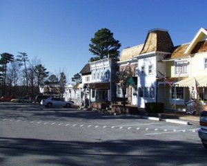
Pine Mountain Village
They sold a lot of antiques in this area.
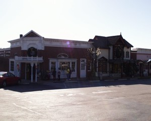
Pine Mountain Village
I noticed they also had a Christmas store in this small shopping center.
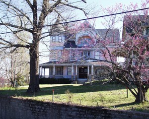
Eureka Springs
Queen Anne Victorian Bed and Breakfast
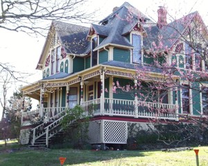
Eureka Springs
Queen Anne Mansion Victorian Tour Home
After my stop in Eureka Springs, it was basically a race to get back to Branson before dark. I briefly got disoriented because while continuing down 62 I kept expecting Highway 37 north to be soon. (U.S. roads are great but they don't put up many signs along the way!) What I hadn't considered in the planning was that Highway 62 continued to be an unending amount of switchbacks up then down, up then down. Eighteen miles on a map easily translated to at least three times that when you considered all the turns!
When I finally got to 37, I was only briefly on it before heading up 112 then 76 east. That route took me straight through the Mark Twain National Forest and I only regret that my race against the sun setting prevented me from stopping and enjoying my surroundings. I'd say that of all the places I road through, the forest was the most peacefully awesome. As I drove through the forest, I passed at least a dozen bikes, half Harleys or Harley wanna-bees and half sport bikes. No wonder since the ride was as awesome as the view. I barely beat the setting sun. I pulled into Branson about a minute (no kidding) before the sun was so low, you couldn't see it because it was hidden behind the mountains.
That night I skipped dinner (that catfish meal was BIG!) and went to Ripley's Believe It or Not. Totally a waste of cash since the displays were boring!